Updated road closures in Matlock, Peak District, Buxton and across Derbyshire as flooding hits
and live on Freeview channel 276
Below is the latest list of roads closed due to surface water flooding, updated at 2pm on Monday, February 21. They include:
A53 Leek Road
A61 from Little Eaton roundabout (junction with the A38) south into Derby

A6 at Buxton and Rowsley
Advertisement
Hide AdAdvertisement
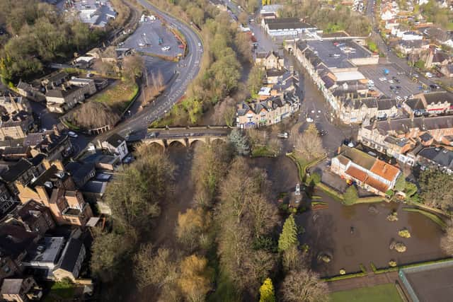
Hide AdA615/A6 Bakewell Road, Matlock between Crown Square and the Arc leisure centre
A6 at Matlock Bath
A6 south of Milford between 'Moscow Straight' and Duffield
Makeney Road, Makeney between its junction with the A6 at Milford and Red Lane
B5057 Darley Bridge including all lanes that feed into Four Lanes End
A6020 between Ashford in the Water and Hassop roundabout
B6001 Hassop roundabout to Calver
A57 Snake Pass
A57 at Woolley Bridge, Hadfield
A610 Ambergate near the Hurt Arms
Asher Lane, Pentrich
Belper Lane junction of the A517 Belper near Bridgefoot
Please remember that additional local roads may be closed across the county due to localised surface water flooding. Stay alert, stay safe and do not attempt to drive through flood water.
Advertisement
Hide AdAdvertisement
Hide Ad