
350 new homes are proposed for greenfield site in north Derbyshire in outline planning application submitted to council
An outline planning application for up to 350 new houses to be built on green fields in north Derbyshire has been submitted to a planning authority.
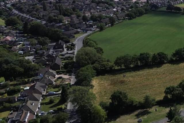
Hallam Land is bidding for consent from North East Derbyshire District Council to develop agricultural land spanning 13.86 hectares between Old Tupton and Holmgate. The land is to the west of Coupe Lane, Old Tupton.
On behalf of the applicants, Marrons and Nineteen47 undertook a public consultation exercise in the latter half of 2025, distributing 1190 leaflets to residential addresses and businesses informing them of the proposed development and hosting a consultation website which set out the details. A response of 2.2% to the leaflet distribution was recorded among a total of 26 responses, one of which was a duplicate.
Seventeen responses raised concerns about highway matters: the safety and capacity of the highway network, the safety/implications of the proposed access, the availability of public transport, pedestrian safety, and lack of parking.

Concern about the strain on infrastructure, particularly education facilities, dental and medical centres was among the key points raised. The Local Education Authority will assess whether there is a need for additional school capacity. If required and justified, the applicant will make a financial contribution to support education facilities under planning obligations.
The mix of houses is to be determined at detailed design stage but is likely to include 1-5 bedroom detached, semi-detached homes and short terraces. An equipped playspace to be used by existing and new residents is included in the proposal as is vehicular access to the site from Coupe Lane.
Hallam Land’s plan includes maintaining the site’s Public Right of Way that links Coupe Lane with the residential development along Ashover Road. Existing vegetation and hedgerows throughout the site will be retained where possible. A combined footpath and cycleway would run alongside the retained vegetation. There would be a retained green buffer to the southwest, offering separation between the scheme and Millfield Camping Park and countryside.
The land earmarked for the housing development sits within flood zone 1, at the lowest risk of flooding.
Hallam Land Management submitted a similar plan for the greenfield site that was withdrawn in 2021 without a decision after it attracted objections.
*For the latest public notices from your area, please visit https://publicnoticeportal.uk