
Outline planning consent for former Chesterfield church to be demolished and replaced by block of flats
Outline planning permission has been granted to knock down a former church and redevelop the site as residential accommodation.
The proposal for 200 Derby Road, Chesterfield encompasses the Church of the Holy Family, which closed for worship in September 2023, an associated bungalow and hall. A hree-storey block accommodating nine two-bedroom flats, with parking to the rear, would be built on the site.
James Pemberton of JUMP Architects Ltd submitted the application to Chesterfield Borough Council on behalf of John Clarke, a trustee of the Diocese of Hallam, in July 2025.
A nearby resident objected to the application shortly after it was made public, stating that their property would be overlooked from windows at the back of the proposed flats and that the car parking plans for 18 cars would directly. overlook the garden and property of 202 Derby Road.
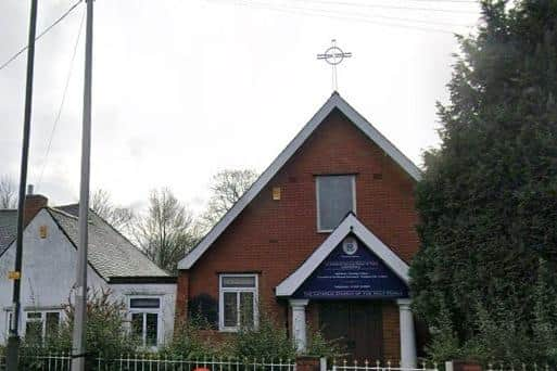

in their letter of objection, the correspondent wrote: “A three-storey building so close to a semi-detached house would certainly create a feeling of claustrophobia and dominance from one side. I see nothing in the proposed plans to mitigate any of this. The proposed building is out of kilter with the other housing on Derby Road, where the vast majority of houses are semi-detached or terraced housing.
"The Human Rights Act states a person has the right to a peaceful enjoyment of all their possessions, including their home and other land. Living next door to a block of flats with 18 cars will affect this peaceful enjoyment and privacy on many levels.”
The letter-writer commented that this section of Derby Road was often highly congested and the addition of 18 cars coming in and out of this development would add to the bottleneck.
They also cited the frequent flooding that Chesterfield has experienced in recent years and wrote: “Given this proposed development is on slightly higher ground to 202 and 204 we do not know the risk additional properties place on our homes.”
A flood risk assessment, submitted to the council in September 2025, stated: “Historical flooding related to the exceedance of the channel capacity of the River Rother is understood to have previously occurred at the site; however, the area of the proposed residential development was not impacted by the flooding.
“According to the Environment Agency’s (EA) Flood Map for Planning Purposes, the site is located partially within fluvial Flood Zones 1 (low probability), 2 (medium probability), and 3 (high probability). The proposed residential building is located entirely within Flood Zone 1.”