Step out on this circular walk around Linacre Reservoir and Old Brampton
and live on Freeview channel 276
It starts from the Holmebrook Valley Park north car park off Meadow Lane SK 356 731.
Take the broad track heading due south that has the children’s play area to its left and ends at a broad crossing path. Cross straight over the crossing path and pass through the gap in the wooden barrier, just to the right of the large display board, onto a grass covered path.
Advertisement
Hide AdAdvertisement
Hide AdFollow this path which winds down the slope to arrive at the left-hand side of the lake. At this point the path joins a broad track. Follow this track as it veers to the right keeping the edge of the lake on your right. Continue along the track until it reaches a broad junction of several paths.

MORE TO READ: Here are 10 great places you could visit for a staycation in the Peak District as lockdown eases
Here turn sharp left and cross a wooden bridge. Immediately after crossing the bridge look for a footpath on the right which heads into a narrow band of woodland. Take this path which winds through the wood with Holme Brook on your right. Eventually you reach a wooden footbridge over the brook.
Cross the bridge with care and then turn sharp left to follow a concession path with Holme Brook now on your left-hand side. Continue until you reach a metal kissing gate. Pass through the gate to enter an enclosed section of track with trees on both sides, at the end of which is a metal pedestrian gate.
Go through the gate and down a short flight of steps. After a short distance cross the brook on a wooden footbridge. Climb up the short flight of steps through the trees bordering the brook. The path now veers right and passes into a field, follow another short section of path with trees on your immediate right to reach another metal gate. Go through the gate onto Woodnook Lane. Turn left and walk up the lane until you reach Ashgate Road ignoring any crossing paths.
Advertisement
Hide AdAdvertisement
Hide AdAt the road turn left and walk about 120m when Ivy Cottage will be on your left. Opposite the cottage is a bridleway indicated by a metal sign. Walk down the bridleway known as Piper Lane. Where it forks take the right-hand track. After about 750m you reach Broomhall Farm on your left. About 120m passed the farm is a track (bridleway) on the right (unsigned) which heads uphill. Follow this until it reaches the Main Road at Old Brampton.
Cross the road carefully and turn left to reach Old Brampton church. Look at the church clock and note the extra minutes for latecomers to services. Go past the church and then turn right down the bridleway by the phone box. Almost immediately i. e. after about 60m there is a stile in the wall on your left.
Cross the stile and turn sharp right proceeding down the path at the field edge. Locate the stile over the stone wall- it is in the right-hand corner of the field. Cross this stile then continue to follow the field edge which bends left. At the bottom right corner there is a gap in the remains of a wall.
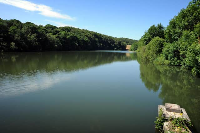
Go through the gap to enter the woodland surrounding Linacre Reservoirs and descend one flight of steps. At the bottom of these steps is a broad track, turn left here ignoring the second set of steps. Follow the track up a short slope to the southern end of Linacre middle dam wall.
Advertisement
Hide AdAdvertisement
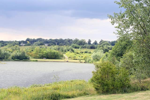
Hide AdCross the dam wall then bear right and follow the track to a pedestrian gate at the side of a field gate. After going through the gate turn right along the track. After about 100m just before the public conveniences and ranger station there is a footpath going left up some steps. Climb these steps to a wall.
Pass through the gap in the wall into a field and follow the broad track across it to a section of woodland. Enter the woods and continue on a broad track to the far side of the wood. Ignore crossing paths and continue on the path as it veers right to reach a gateway in the boundary edge of a field.
Pass through the gateway then walk with the field boundary on your immediate right. Just before the path reaches Cutthorpe Road the path crosses into the adjacent field. The field boundary is now on your left. Cross a stile in the wall to reach the road.
Turn right and proceed along the footway for 130m until you reach a signed bridleway, Green Lane, going off to the right. Follow this until you reach a farm track on your left before Cutthorpe Hall. Take the farm track and immediately pass through a pedestrian gate on your left.
Advertisement
Hide AdAdvertisement
Hide AdNow follow the path alongside the right-hand field boundary to a stile. After crossing the stile turn sharp left and follow the path which becomes a track with the field boundary on your left. Continue through a pedestrian gate by a field gate to reach the Main Road at Cutthorpe for the second time.
Turn right and walk along the footway until the road bends sharply to the left. Look for a fingerpost on the right-hand side of the main road indicating the bridleway down Brockwell Lane. Proceed along Brockwell Lane ignoring any paths branching off to the right until you reach a point where a broad track joins Brockwell Lane from the left. Turn left onto this track and follow it back to the car park.
To join Chesterfield and Northeast Derbyshire Ramblers on this walk at 10am on Saturday 21st August, contact Mel Hardy on 07702629991
See Ordnance Survey Chesterfield and Alfreton Number269 to follow the route on a map.